Easier access to realtime and historic NERACOOS buoy observations.
Brought to you by NOAA IOOS NERACOOS
|
|
ERDDAP
Easier access to realtime and historic NERACOOS buoy observations. |
Brought to you by NOAA IOOS NERACOOS |
| Row Type | Variable Name | Attribute Name | Data Type | Value |
|---|---|---|---|---|
| attribute | NC_GLOBAL | algorithm_ids | String | OCR504_1.8: 02-Oct-2023 15:55:04\nOCR507_1.8: 02-Oct-2023 15:55:04\nDFLS_Chlorophyll_1.7: 02-Oct-2023 15:55:04\nFLCDS_CDOM_1.1: 02-Oct-2023 15:55:04\nFLNTUS_Chlorophyll_1.6: 02-Oct-2023 15:55:04 |
| attribute | NC_GLOBAL | averaging_period | int | 1 |
| attribute | NC_GLOBAL | averaging_period_units | String | Minutes |
| attribute | NC_GLOBAL | breakout_id | int | 22 |
| attribute | NC_GLOBAL | buffer_type | String | optics_s |
| attribute | NC_GLOBAL | cdm_data_type | String | TimeSeries |
| attribute | NC_GLOBAL | cdm_timeseries_variables | String | station, longitude, latitude |
| attribute | NC_GLOBAL | clock_time | String | Center of period |
| attribute | NC_GLOBAL | contact | String | [email protected],[email protected],[email protected] |
| attribute | NC_GLOBAL | Conventions | String | CF-1.6, COARDS, Unidata Dataset Discovery v1.0 |
| attribute | NC_GLOBAL | creator_email | String | [email protected],[email protected],[email protected] |
| attribute | NC_GLOBAL | creator_name | String | Neal Pettigrew |
| attribute | NC_GLOBAL | creator_url | String | http://gyre.umeoce.maine.edu
|
| attribute | NC_GLOBAL | defaultGraphQuery | String | time,chlorophyll&time%3E=now-7days&.draw=lines&.color=0x000000 |
| attribute | NC_GLOBAL | delta_t | int | 60 |
| attribute | NC_GLOBAL | depth_datum | String | Sea Level |
| attribute | NC_GLOBAL | Easternmost_Easting | double | -70.5655 |
| attribute | NC_GLOBAL | ending_julian_day_number | double | 60464.58333333349 |
| attribute | NC_GLOBAL | ending_julian_day_string | String | 2024-06-03 14:00:00 |
| attribute | NC_GLOBAL | featureType | String | TimeSeries |
| attribute | NC_GLOBAL | FLNTUS_manufacturer | String | Wet-Labs |
| attribute | NC_GLOBAL | FLNTUS_serial_number | int | 468 |
| attribute | NC_GLOBAL | geospatial_lat_max | double | 42.52433 |
| attribute | NC_GLOBAL | geospatial_lat_min | double | 42.5232 |
| attribute | NC_GLOBAL | geospatial_lat_units | String | degrees_north |
| attribute | NC_GLOBAL | geospatial_lon_max | double | -70.5655 |
| attribute | NC_GLOBAL | geospatial_lon_min | double | -70.5667 |
| attribute | NC_GLOBAL | geospatial_lon_units | String | degrees_east |
| attribute | NC_GLOBAL | geospatial_vertical_max | double | 3.0 |
| attribute | NC_GLOBAL | geospatial_vertical_min | double | 3.0 |
| attribute | NC_GLOBAL | geospatial_vertical_positive | String | down |
| attribute | NC_GLOBAL | geospatial_vertical_units | String | m |
| attribute | NC_GLOBAL | goes_platform_id | String | 0441F72A |
| attribute | NC_GLOBAL | id | String | A01-optics_s |
| attribute | NC_GLOBAL | infoUrl | String | http://www.neracoos.org/ |
| attribute | NC_GLOBAL | institution | String | Univ. of Maine |
| attribute | NC_GLOBAL | institution_url | String | http://gyre.umeoce.maine.edu
|
| attribute | NC_GLOBAL | julian_day_convention | String | Julian date convention begins at 00:00:00 UTC on 17 November 1858 AD |
| attribute | NC_GLOBAL | keywords | String | a01, buoy, chemistry, chlorophyll, chlorophyll data_quality, chlorophyll data_quality_flag, chlorophyll data_quality_level, chlorophyll data_quality_stage, chlorophyll_concentration_in_sea_water, circulation, color, concentration, conductivity, currents, data, density, department, depth, Earth Science > Oceans > Ocean Chemistry > Chlorophyll, Earth Science > Oceans > Ocean Chemistry > Oxygen, Earth Science > Oceans > Ocean Circulation > Ocean Currents, Earth Science > Oceans > Ocean Optics > Turbidity, Earth Science > Oceans > Ocean Pressure > Sea Level Pressure, Earth Science > Oceans > Ocean Temperature > Water Temperature, Earth Science > Oceans > Ocean Waves > Significant Wave Height, Earth Science > Oceans > Ocean Waves > Wave Period, Earth Science > Oceans > Ocean Winds > Surface Winds, Earth Science > Oceans > Salinity/Density > Conductivity, Earth Science > Oceans > Salinity/Density > Density, Earth Science > Oceans > Salinity/Density > Salinity, flag, height, level, maine, marine, name, neracoos, o2, ocean, ocean color, oceanography, oceans, optics, oxygen, period, physical, pressure, quality, realtime, salinity, school, sciences, sea, seawater, sensor, significant, stage, station, station_name, surface, temperature, time, turbidity, turbidity data_quality, turbidity data_quality_flag, turbidity data_quality_level, turbidity data_quality_stage, turbidity_of_sea_water, university, water, wave, waves, winds |
| attribute | NC_GLOBAL | keywords_vocabulary | String | GCMD Science Keywords |
| attribute | NC_GLOBAL | license | String | The data may be used and redistributed for free but is not intended\nfor legal use, since it may contain inaccuracies. Neither the data\nContributor, ERD, NOAA, nor the United States Government, nor any\nof their employees or contractors, makes any warranty, express or\nimplied, including warranties of merchantability and fitness for a\nparticular purpose, or assumes any legal liability for the accuracy,\ncompleteness, or usefulness, of this information. |
| attribute | NC_GLOBAL | long_name | String | A01 Massachusetts Bay Optics_s Std_flntus |
| attribute | NC_GLOBAL | magnetic_variation | double | -14.8 |
| attribute | NC_GLOBAL | Metadata_Conventions | String | CF-1.6, COARDS, Unidata Dataset Discovery v1.0 |
| attribute | NC_GLOBAL | mooring_site_id | String | A0147 |
| attribute | NC_GLOBAL | mooring_type | String | Slack |
| attribute | NC_GLOBAL | naming_authority | String | edu.maine |
| attribute | NC_GLOBAL | ndbc_site_id | String | 44029 |
| attribute | NC_GLOBAL | neracoos_data_provider | String | UMO |
| attribute | NC_GLOBAL | Northernmost_Northing | double | 42.52433 |
| attribute | NC_GLOBAL | number_observations_per_hour | int | 1 |
| attribute | NC_GLOBAL | number_samples_per_observation | int | 1 |
| attribute | NC_GLOBAL | optics_package | String | STD FLNTUS |
| attribute | NC_GLOBAL | position_datum | String | WGS 84 |
| attribute | NC_GLOBAL | processing | String | realtime |
| attribute | NC_GLOBAL | project | String | NERACOOS |
| attribute | NC_GLOBAL | project_url | String | http://gomoos.org
|
| attribute | NC_GLOBAL | publisher | String | NERACOOS |
| attribute | NC_GLOBAL | publisher_email | String | info at neracoos.org |
| attribute | NC_GLOBAL | publisher_name | String | Northeastern Regional Association of Coastal and Ocean Observing Systems (NERACOOS) |
| attribute | NC_GLOBAL | publisher_phone | String | (603) 319 1785 |
| attribute | NC_GLOBAL | publisher_url | String | http://www.neracoos.org/ |
| attribute | NC_GLOBAL | references | String | http://gyre.umeoce.maine.edu/data/gomoos/buoy/doc/buoy_system_doc/buoy_system/book1.html
|
| attribute | NC_GLOBAL | short_name | String | A01 |
| attribute | NC_GLOBAL | source | String | Ocean Data Acquisition Systems (ODAS) Buoy |
| attribute | NC_GLOBAL | sourceUrl | String | (local files) |
| attribute | NC_GLOBAL | Southernmost_Northing | double | 42.5232 |
| attribute | NC_GLOBAL | standard_name_vocabulary | String | CF-1.6 |
| attribute | NC_GLOBAL | starting_julian_day_number | double | 60208.0 |
| attribute | NC_GLOBAL | starting_julian_day_string | String | 2023-09-21 00:00:00 |
| attribute | NC_GLOBAL | station_name | String | A01 |
| attribute | NC_GLOBAL | station_photo | String |  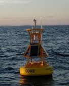 http://gyre.umeoce.maine.edu/gomoos/images/generic_buoy.png http://gyre.umeoce.maine.edu/gomoos/images/generic_buoy.png
|
| attribute | NC_GLOBAL | station_type | String | Surface Mooring |
| attribute | NC_GLOBAL | subsetVariables | String | station, longitude, latitude, depth |
| attribute | NC_GLOBAL | summary | String | Ocean observation data from the Northeastern Regional Association of Coastal & Ocean Observing Systems (NERACOOS). The NERACOOS region includes the northeast United States and Canadian Maritime provinces, as part of the United States Integrated Ocean Observing System (IOOS). These data are served by Unidata's Thematic Realtime Environmental Distributed Data Services (THREDDS) Data Server (TDS) in a variety of interoperable data services and output formats. |
| attribute | NC_GLOBAL | time_coverage_end | String | 2024-06-03T14:00:00Z |
| attribute | NC_GLOBAL | time_coverage_start | String | 2005-10-22T12:00:00Z |
| attribute | NC_GLOBAL | time_zone | String | UTC |
| attribute | NC_GLOBAL | title | String | A01 Optics - Chlorophyll / Turbidity |
| attribute | NC_GLOBAL | uscg_light_list_letter | String | A |
| attribute | NC_GLOBAL | uscg_light_list_number | String | 367 |
| attribute | NC_GLOBAL | watch_circle_radius | int | 45 |
| attribute | NC_GLOBAL | water_depth | double | 65.0 |
| attribute | NC_GLOBAL | Westernmost_Easting | double | -70.5667 |
| variable | station | String | ||
| attribute | station | cf_role | String | timeseries_id |
| attribute | station | ioos_category | String | Identifier |
| attribute | station | long_name | String | Station A01 |
| variable | mooring_site_desc | String | ||
| attribute | mooring_site_desc | ioos_category | String | Location |
| attribute | mooring_site_desc | long_name | String | Station Description |
| variable | time | double | ||
| attribute | time | _ChunkSizes | int | 512 |
| attribute | time | _CoordinateAxisType | String | Time |
| attribute | time | actual_range | double | 1.1299824E9, 1.7174232000000134E9 |
| attribute | time | axis | String | T |
| attribute | time | calendar | String | gregorian |
| attribute | time | ioos_category | String | Time |
| attribute | time | long_name | String | Time |
| attribute | time | standard_name | String | time |
| attribute | time | time_origin | String | 01-JAN-1970 00:00:00 |
| attribute | time | units | String | seconds since 1970-01-01T00:00:00Z |
| variable | chlorophyll | float | ||
| attribute | chlorophyll | _ChunkSizes | int | 985 |
| attribute | chlorophyll | _FillValue | float | -999.0 |
| attribute | chlorophyll | actual_range | float | 0.0, 162.5601 |
| attribute | chlorophyll | ancillary_variables | String | chlorophyll_qc |
| attribute | chlorophyll | colorBarMaximum | double | 30.0 |
| attribute | chlorophyll | colorBarMinimum | double | 0.03 |
| attribute | chlorophyll | colorBarScale | String | Log |
| attribute | chlorophyll | coordinates | String | time lon lat depth |
| attribute | chlorophyll | ioos_category | String | Ocean Color |
| attribute | chlorophyll | is_dead | float | 0.0 |
| attribute | chlorophyll | long_name | String | Chlorophyll |
| attribute | chlorophyll | short_name | String | Chl |
| attribute | chlorophyll | standard_name | String | chlorophyll_concentration_in_sea_water |
| attribute | chlorophyll | units | String | micrograms/liter |
| attribute | chlorophyll | valid_range | float | 0.0, 30.0 |
| variable | chlorophyll_qc | byte | ||
| attribute | chlorophyll_qc | _ChunkSizes | int | 3938 |
| attribute | chlorophyll_qc | _FillValue | byte | -128 |
| attribute | chlorophyll_qc | actual_range | byte | 0, 99 |
| attribute | chlorophyll_qc | colorBarMaximum | double | 128.0 |
| attribute | chlorophyll_qc | colorBarMinimum | double | 0.0 |
| attribute | chlorophyll_qc | coordinates | String | time lon lat depth |
| attribute | chlorophyll_qc | flag_meanings | String | quality_good out_of_range sensor_nonfunctional insufficient_FLNTUS_counts invalid_temperature_input |
| attribute | chlorophyll_qc | flag_values | byte | 0, 1, 2, 19, 25 |
| attribute | chlorophyll_qc | intent | String | data_quality |
| attribute | chlorophyll_qc | ioos_category | String | Quality |
| attribute | chlorophyll_qc | long_name | String | Chlorophyll Quality |
| attribute | chlorophyll_qc | short_name | String | ChlQ |
| attribute | chlorophyll_qc | standard_name | String | chlorophyll data_quality |
| attribute | chlorophyll_qc | units | String | 1 |
| attribute | chlorophyll_qc | valid_range | byte | -127, 127 |
| variable | turbidity | float | ||
| attribute | turbidity | _ChunkSizes | int | 985 |
| attribute | turbidity | _FillValue | float | -999.0 |
| attribute | turbidity | actual_range | float | 0.0, 25.952 |
| attribute | turbidity | ancillary_variables | String | turbidity_qc |
| attribute | turbidity | colorBarMaximum | double | 250.0 |
| attribute | turbidity | colorBarMinimum | double | 0.0 |
| attribute | turbidity | coordinates | String | time lon lat depth |
| attribute | turbidity | ioos_category | String | Unknown |
| attribute | turbidity | is_dead | float | 0.0 |
| attribute | turbidity | long_name | String | Turbidity |
| attribute | turbidity | short_name | String | Tur |
| attribute | turbidity | standard_name | String | turbidity_of_sea_water |
| attribute | turbidity | units | String | ntus |
| attribute | turbidity | valid_range | float | 0.0, 30.0 |
| variable | turbidity_qc | byte | ||
| attribute | turbidity_qc | _ChunkSizes | int | 3938 |
| attribute | turbidity_qc | _FillValue | byte | -128 |
| attribute | turbidity_qc | actual_range | byte | 0, 99 |
| attribute | turbidity_qc | colorBarMaximum | double | 128.0 |
| attribute | turbidity_qc | colorBarMinimum | double | 0.0 |
| attribute | turbidity_qc | coordinates | String | time lon lat depth |
| attribute | turbidity_qc | flag_meanings | String | quality_good out_of_range sensor_nonfunctional insufficient_FLNTUS_counts invalid_temperature_input |
| attribute | turbidity_qc | flag_values | byte | 0, 1, 2, 19, 25 |
| attribute | turbidity_qc | intent | String | data_quality |
| attribute | turbidity_qc | ioos_category | String | Quality |
| attribute | turbidity_qc | long_name | String | Turbidity Quality |
| attribute | turbidity_qc | short_name | String | TurQ |
| attribute | turbidity_qc | standard_name | String | turbidity data_quality |
| attribute | turbidity_qc | units | String | 1 |
| attribute | turbidity_qc | valid_range | byte | -127, 127 |
| variable | longitude | float | ||
| attribute | longitude | _CoordinateAxisType | String | Lon |
| attribute | longitude | actual_range | float | -70.5667, -70.5655 |
| attribute | longitude | axis | String | X |
| attribute | longitude | colorBarMaximum | double | 180.0 |
| attribute | longitude | colorBarMinimum | double | -180.0 |
| attribute | longitude | ioos_category | String | Location |
| attribute | longitude | long_name | String | Longitude |
| attribute | longitude | standard_name | String | longitude |
| attribute | longitude | units | String | degrees_east |
| variable | latitude | float | ||
| attribute | latitude | _CoordinateAxisType | String | Lat |
| attribute | latitude | actual_range | float | 42.5232, 42.52433 |
| attribute | latitude | axis | String | Y |
| attribute | latitude | colorBarMaximum | double | 90.0 |
| attribute | latitude | colorBarMinimum | double | -90.0 |
| attribute | latitude | ioos_category | String | Location |
| attribute | latitude | long_name | String | Latitude |
| attribute | latitude | standard_name | String | latitude |
| attribute | latitude | units | String | degrees_north |
| variable | depth | float | ||
| attribute | depth | _CoordinateAxisType | String | Height |
| attribute | depth | _CoordinateZisPositive | String | down |
| attribute | depth | actual_range | float | 3.0, 3.0 |
| attribute | depth | axis | String | Z |
| attribute | depth | colorBarMaximum | double | 8000.0 |
| attribute | depth | colorBarMinimum | double | 0.0 |
| attribute | depth | colorBarPalette | String | OceanDepth |
| attribute | depth | ioos_category | String | Location |
| attribute | depth | long_name | String | Depth |
| attribute | depth | positive | String | down |
| attribute | depth | standard_name | String | depth |
| attribute | depth | units | String | m |